-
Chapter 1: LAND AND PEOPLE
Introduction
India has an area of 3.28 million square km. It ranks seventh in the world in size [2.4% of land mass] and second in population [17% of world]. It lies completely in northern hemisphere. The land frontier is 15200 km and sea frontier is 7517 km including the islands. The North South extent is 3214 km and the East West extent is 2933 km. North India lies in the subtropical or warm temperate zone and South India lies in the tropics.
It extends from 8° to 38° N and 67° to 98° East. Its latitudinal and longitudinal extent is 30° and its standard meridian is 82° 30". India has 6100 km long coastline and 7517 km if islands are included.
It has 7 neighbours excluding Tibet. It is separated from Sri Lanka by Palk strait and Gulf of Mannar. Gujarat has the largest coastline and Bangladesh shares the largest border with India.
Physical Features
The Himalayan wall extends upto 2400 km and has a width of 320 km. In the north east the Garo, Khasi, Jaintia and Naga hills run almost west to east and meet the North south chain of Rakhine and Mizo hills. Himalayas are in the North, Hindukush and Sulaiman in North west and Purvachal in North east. However mountain passes of Khyber, Bolan, Bomdila, Shipkala, Nathula, Khurram and Gomal make entrance into the subcontinent possible. Karewa formation is seen in the Kashmir himalayas.
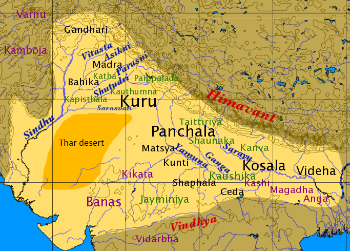
Great Indian desert extends from Rann of Kutch to Luni and little desert from Luni to north west. The land between them is absolutely sterile country.

Fig 1: Great and little desert of India
Geological history
The Himalayas are of marine origin and a result of mountain building process which started 7 crore years ago. The peninsular region has metamorphosed rocks dating back to 380 crore years ago. The remaining part of it is covered by lava flows belonging to Deccan trap and younger sediments.
Rivers:
Rivers are Himalayan, Deccan, Western coastal and Inland drainage. Apart from Himalayan all the others are non perennial. The coastal rivers are mostly in west coast and inland drainage rivers are in west Rajasthan and of ephemeral nature.
India has 20 river basins with 12 being major and remaining 8 are composite. Srinagar is located on the banks of the Jhelum.
Coromandal coast lies between Eastern ghats and Bay of Bengal.
Bay of bengal has 572 islets. The two main islets are Richie and Labyrinth
The Bay of bengal islands [Andaman and Nicobar] are separated by the 10° channel
Barren island is India's only Active volcano.
Saddle peak is the highest peak in the A&N islands.
Arabian islands (Lakshadweep) are separated by the 11° channel. Minicoy is the largest island in that group.
River Kosi is known as the "Sorrow of Bihar".
River Godavari is Dakshin Ganga , it rises in Nashik.
River Damodar is known as the "Sorrow of Bengal".
Chilika Lake in Odisa is the largest salt water lake in India.
Wular lake - Jammu Kashmir is the largest freshwater lake in India.
Climates:
There are official four seasons in India: Winter, Pre-monsoon / Summer, Monsoon and Post-monsoon. South India receives more rainfall than North.In post monsoon, the North India is usually cloudless from October to November. Himalayan states being temperate experience two more seasons like Spring and Autumn.
Flora and Fauna:
The flora is being classified by Botanical Survey of India, Kolkata which publishes Red Data Book of endangered species. The Wildlife institute of India has divided country into 10 zones and India hold 7.5% of World's animals.
Census:
Census 2011 was the 15th census of India. The density increased to 382 persons / sq. km. The sex ratio improved to 943 and the literacy rate also improved to 73%. The population has increased every decade since 1901 except during 1911 - 1921. Nagaland only state with negative growth rate.
Density increased in all states with Bihar being most dense. Kerela has highest literacy in overall, male ad female. Similarly Bihar is lowest in overall, male and female category.[ Person who can read and write are literate].
Kerela and Puducherry only places with above 1000 sex ratio.
UP has highest percentage of India's population 16% and Lakshadweep has lowest.
Total SC's in population are 16.6% with Punjab, Himachal Pradesh having highest share to their total population. Mizoram, Meghalaya having highest share to total population of ST's.
31% of Indians stay in Urban areas.Highest number of vilages are in UP, MP and Odissa.
Solved Question Papers
Q.Indira Gandhi Peace Prize for Peace, Disarmament and Development for 2014 was given to which of the following? (UPSC CSAT 2015)
Bhabha Atomic Research Centre
Indian Institute of Science
Indian Space Research Organization
Tata Institute of Fundamental Research
Ans . C
The Indira Gandhi Prize or the Indira Gandhi Peace Prize or the Indira Gandhi Prize for Peace, Disarmament and Development is the prestigious award.
Accorded annually by India to individuals or organizations in recognition of creative efforts toward promoting international peace, development and a new international economic order;
ensuring that scientific discoveries are used for the larger good of humanity, and enlarging the scope of freedom.
The prize carries a cash award of 2.5 million Indian rupees and a citation. The recipients are chosen from a pool of national and international nominees. Angel Merkel (2013) and ISRO (2014) were the recipients of the award
Official YouTube Channel of UPSCFEVER - #1
Quiz
Score more than 80% marks and move ahead else stay back and read again!