-
Chapter 1: INTRODUCTION TO GEOGRAPHY
Introduction
Geography – it means “Study of the Earth”. It has two parts:
Physical geography:
A. Landforms
B. Atmosphere,
C. Hydrosphere,
D. Biosphere.
Human geography:
A. Habitation
B. Population
C. Agriculture
D. Location of Industries.
Fundamentals of geography:
1. Latitudes:
a. They represent angular distance from center of the earth.
b. Latitudes or “Parallels” are concentric circles.
c. Largest latitude: Equator [0°]
d. Tropic regions: From equator to 23.5° N “Tropic of Cancer” and 23.5°S “Tropic of Capricorn”. Heat surplus regions.
e. Temperate regions: from 23.5°N to 66.5°N and 23.5°S to 66.5°S. Heat deficit regions.
f. Differential heating is responsible for different pressure and planetary winds.
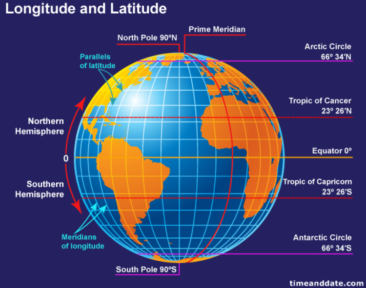
Fig 1: Longitude and Latitude
2. Seasons:
a. The Earth is tilted on its axis by angle of 23.5°. This is the reason for the seasons. The variation in the length of day and night from seasons is also due to the tilt.
b. The Earth completes a rotation around sun in 365 days. In March the hemispheres are equidistant from the sun this is spring.
c. In June the northern hemisphere is closer to the sun so it’s summer in the north and winter in the south.
d. The autumn is in September when again both hemispheres are equidistant. In December the southern hemisphere is closer to the sun and hence there is summer in the south and winter in the north.
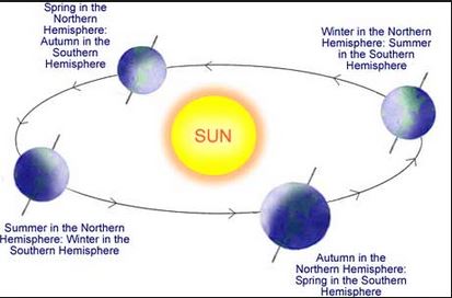
Fig 2: Revolution of Earth
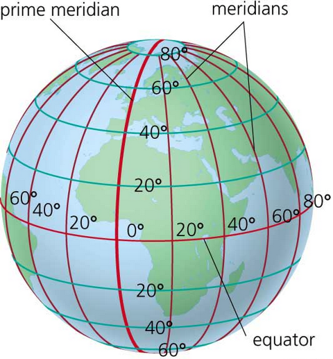
3. Longitudes / Meridiansa. They are the angular distance of a place from the prime meridian [0°].
b. 0° = Greenwich line, UK and 180° = international date line
c. From International Date Line moving to east subtracts a day and moving west adds a day. Western hemisphere is one day behind and eastern hemisphere is one day ahead.
d. Every country selects its standard meridian [for India – 82.5°]. India’s time is 5.5 hrs ahead of Greenwich meridian time.
Miscellaneous Examples:
Note: France has the highest number of time zones --> 12.
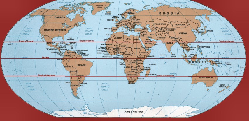
- The Equator passes through: Ecuador, Colombia, Brazil, Congo, Uganda, Kenya, Somalia, Maldives, and Indonesia.
- Tropic of Capricorn: Chile, Argentina, Paraguay, Brazil, Botswana, Madagascar and Australia.
- Tropic of Cancer: Mexico, Algeria, Niger, Libya, Egypt, Saudi Arabia, India, China, Oman, Bangladesh, Burma and Taiwan.
- GMT runes through United Kingdom, France, Spain, Algeria, Mali and Ghana in Africa
- IST runs through UP, MP, Orissa and Chhattisgarh
Chapter Review
Score more than 80% marks and move ahead else stay back and read again!