-
Chapter 8: MOTION OF OCEANIC WATER
Waves:
Wind pushes the water body. Then gravity pushes the crest downwards and falling water pulls the troughs upwards. Actual motion of water below the surface is circular.
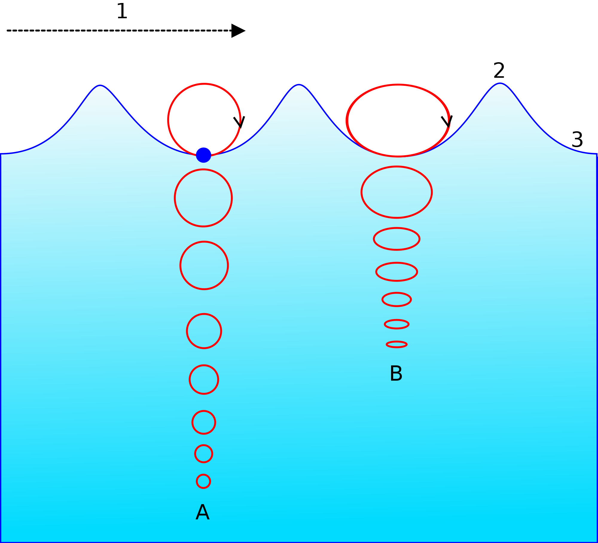
Fig 1: Wave motion
Ocean Currents:
They are shallow and narrow stream of water circulating along the ocean margins. They circumnavigate the world.
The
currents
are created due to
1. Winds – Most currents follow the winds.
2. Coriolis force- the earth’s rotation deflects the ocean currents to east in north and south.
3. Insolation – water at equator is heated and rises. The water at poles cools and sinks, this water flows towards the equator at subsurface level to maintain the loss.
4. Also insolation increases salinity and the high saline water sinks and less saline water rises to the surface. The equator water is less saline [heavy rainfall] and moves to polar high saline water [icebergs].
5.
Gravity
and coastlines.
The best fishing grounds in the world are places where hot and cold current meet like Japan and east coast of America but are foggy areas making it tough for fishing.
The
cold
currents are also responsible for desiccating effect on
the deserts.
The
winter
current in Arabian Sea caused movement of water towards Arabia
and in summer caused movement of water towards India, Thus
facilitating trade.
Upwelling:
- When wind blows in the north direction it creates a flow of water in the western direction. This west flowing water then leads to the divergence at the coast and draws water from below the surface to the top. This is “Upwelling”.
- The cool and nutrient rich water from below comes to the surface. This causes reproduction of phytoplankton and zooplankton.
- When the wind moves southward it causes flow of water towards the coast and this creates down welling.
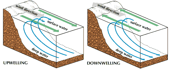
Fig 2: Upwelling and downwelling
Tides:
1. Due to the gravitational pull of the sun and the moon causes tides.
2. The tides depend on depth of ocean, configuration of coastline and openness and closeness of sea.
3. The perigee tides [moon is closer] are higher than apogee tides.
4. When sun, moon and earth are in a line either during full moon and new moon we get spring tide which is the highest high tide and neap tide is when sun, moon and earth are at right angles and this is lowest high tide.
5. In spring tide low tide is lower than usual and in neap tide the low tide is higher than usual.
6. Tides help large ships enter and leave ports. E.g. Kandla and diamond harbor are tidal ports.
Vishakapatnam is deepest landlocked port, Chennai oldest artificial port, Kolkata is oldest port.
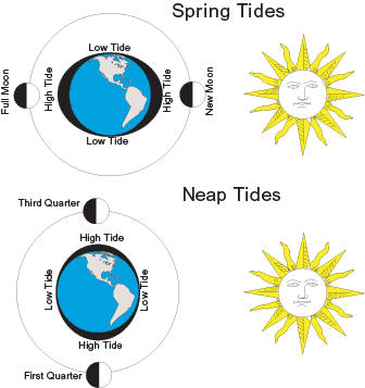
Fig 3: Tides
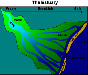
Estuary: mouth of a river is submerged or
low lying under sea water. The river deposit create long narrow
delta like Narmada and Tapti.
Temperature of ocean water
The process of insolation is responsible for ocean temperature. The average temperature of ocean is 3-5°. But the average temperature of surface of ocean is 25°.
It is highest at the tropics not the equator as equator has high cloud cover and rainfall. It decreases towards the poles. For same reason the diurnal temperature range of tropics is higher than equator.
Due to large land mass in the northern hemisphere the temperature of water is higher than in south.
The enclosed seas of tropics are
warmer than open oceans. The enclosed seas of temperate are
cooler than Open Ocean.
Upwelling brings cold water on top but down welling piles warm water on top.
Bigger the size of the ocean better mixing of water and so less annual range of temperature.
Temperature decreases with depth. The decrease rate is higher at equator than the poles.
Salinity of oceans
Sodium chloride is the highest percentage present in ocean. Both sodium and chlorine have high residual time and hence remain in highest proportion.
The proportion of salt remains same in all parts of the ocean.
Salinity decreases from equator to poles but highest salinity is in tropics as equator gets high rainfall and low evaporation due to cloud cover.
Variations in salinity:
1. Salinity increases with high evaporation rate, windy conditions, no fresh water source and down welling.
2. Salinity decreases due to high rainfall, low evaporation rate, upwelling and melting of glaciers.
Solved Question Papers
Q.Tides occur in oceans and seas due to which of the following?
1. Gravitational Force of the Sun
2. Gravitational Force of the Moon
3. Gravitational Force of the Earth
Select the correct answer using the code given below (UPSC CSAT 2015)
1 only
2 and 3 only
1 and 3 only
1, 2, and 3
Ans . D
Tides are the rise and fall of sea levels caused by the combined effects of gravitational forces exerted by the Moon, Sun, and rotation of the Earth.
Q.What explains the eastward flow of the equatorial counter-current? (UPSC CSAT 2015)
The Earth’s rotation on its axis
Convergence of the two equatorial currents
Difference in salinity of water
Occurrence of the belt of calm near equator
Ans . B
The equatorial counter-currents are driven by a distinct surface wind pattern in the tropics. Strong westward trade winds result in westward surface flow in most of the tropical Atlantic and Pacific Oceans. However, several hundred mi. (km.) north of the equator the winds are much weaker, in comparison.
The stronger winds to the south pile up water where the winds are weak.
As a result, the surface of the ocean can be up to 6 in. (15 cm.) higher and the thermocline (region of strongest decrease of temperature with increasing depth) as much as 328 ft. (100 m.) deeper than it is directly to the north. The excess water flows eastward under the influence of the Earth’s rotation, giving rise to the equatorial counter-currents.
Chapter Review
Score more than 80% marks and move ahead else stay back and read again!